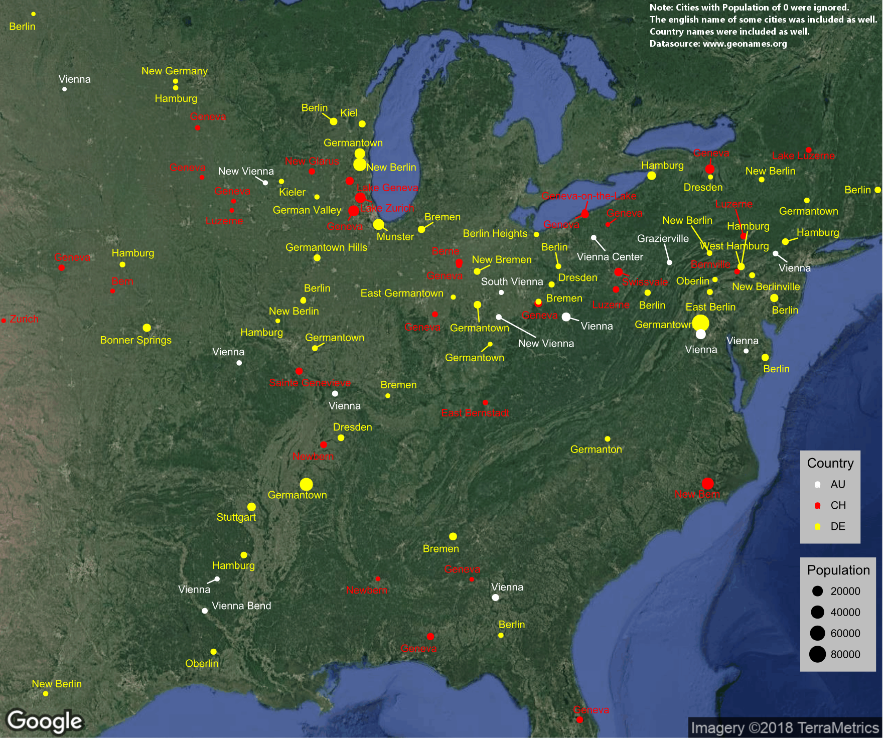
Recently the Swiss ambassador in the United States posted an interesting tweet. It showed a map of places in the US which might have Swiss roots. A little later I found the same map on Reddit too. Reading the discussion and after checking some things myself, I noticed that there were mistakes or the cities weren’t existing anymore. Unfortunately, the ambassador didn’t share any source.
Tell, Wallis, Helvetia, Kloten, Interlaken: do you know how many places in the United States are called after something #Swiss. 🇺🇸🇨🇭Enlarge the map: #SundayMorning pic.twitter.com/CmgKFkE4My
— Martin Dahinden (@Martin_Dahinden) July 8, 2018
The map made me curious and I thought to check myself. I downloaded a list of places in the United States and Canada from www.geonames.org. I imported it into R and filtered it just for the cities and town.
I then created three lists with search-term for Germany, Switzerland and Austria. For Switzerland I used the names of the Kantons, for Germany the names of the 30 biggest cities and for Austria I took the 10 biggest cities and the name of some of the regions. I also translated some names of more famous places to English. I had to do some filtering because a name like “Uri” just gives a ton of wrong results. I then used the search-terms to look through the cities in the US and Canada.
The first result was, that a big part of cities were dead an had a population of zero. I think it was more than half. I had no clue, that there were so many empty towns in the US. I decided to filter those out, because it cluttered everything. Then I had to filter some more for names like “BERNard” and in the end, I went manually trough the list to remove false positives.
After that I just had to visualize it. I used the packages ggplot, ggrepel and ggmap to create the map. I finished it in Gimp. If anyone is interested in the code let me know.
